Services
| Service Info | Details |
|---|---|
| Time | 8 hr |
| Price | Negotiable |
| Locations | Abu Dhabi | SA | OM | UAE | TR | KW |
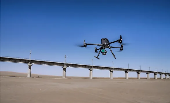
Drone Survey & Mapping
At SpatialWings, we specialize in providing drone-based aerial mapping and surveying services
that deliver precise, high-resolution data for a variety of applications. By employing the latest
drone technology, we capture accurate topographical data, generate detailed 3D models, and
map large areas quickly and efficiently. This approach enables us to support industries such as
construction, agriculture, and environmental monitoring with reliable, real-time data that
enhances project planning and decision-making.
Our experience extends to successful international collaborations, where we’ve applied our
aerial surveying expertise to complex projects across diverse environments. By utilizing drones,
we can access hard-to-reach areas and gather data with greater efficiency than traditional
methods.
As we continue to progress, our goal is to meet the evolving needs of our clients by
providing cost-effective, precise, and timely surveying solutions that streamline operations and
improve overall project outcomes.
Book
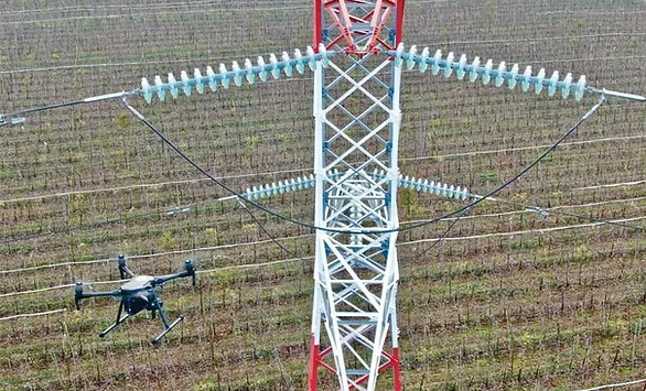
Drone -Asset Inspection
At SpatialWings, we offer drone-based asset inspection services that provide safe, efficient, and
accurate assessments of critical infrastructure. Using advanced drone technology, we can
inspect assets such as bridges, power lines, rooftops, and pipelines, capturing high-quality
images and data without the need for manual labor or disruptive downtime. Our drones allow for
quick and thorough inspections, reducing risks for personnel and minimizing operational
disruptions while delivering comprehensive reports that support maintenance and
decision-making.
With experience in handling a wide range of asset inspection projects, we’ve successfully
partnered with international clients to conduct inspections in challenging environments. Our
approach ensures that every inspection is precise, with high-resolution imagery and detailed
analysis that provides a complete view of asset conditions. By utilizing drones, we are able to
increase efficiency, reduce costs, and improve safety standards for asset management across
various industries.
| Service Info | Details |
|---|---|
| Time | 8 hr |
| Price | Negotiable |
| Location | Customer's Place |

| Service Info | Details |
|---|---|
| Time | 8 hr |
| Price | Negotiable |
| Location | Customer's Place |
Drone Data Analytics & Processing
At SpatialWings, we offer geospatial analysis services that turn aerial data into clear, actionable
information. Using advanced software, we process and analyze high-quality images and
geospatial data to create detailed models and accurate maps. Our solutions help industries like
construction, agriculture, and environmental monitoring make better decisions by providing
reliable and precise data that supports their projects.
With our robust ground station and expertise in drone data processing, we ensure that every
project receives accurate, timely results. We handle complex data efficiently, transforming it into
useful insights that help clients streamline their operations. Whether it’s for large-scale projects
or routine inspections, SpatialWings is dedicated to delivering practical, results-driven solutions
that meet the unique needs of each project.
F.A.Q
Yes, we offer custom drone solutions tailored to the specific needs of each client.
We use top-of-the-line drones equipped with high-resolution cameras, thermal imaging, and multispectral sensors, depending on the project requirements.
Absolutely! We can provide sample reports upon request to showcase the quality and depth of our data analysis.