
Transforming Architecture, Engineering, and Construction with Drone Intelligence

Empower your infrastructure projects with precision drone technology. Monitor progress, inspect hard-to-reach areas, and gather critical data efficiently. Minimize risks, enhance safety, and ensure on-time project delivery. Experience seamless operations with innovative aerial solutions designed for your needs.
HIGHWAYS, BRDIGES, IRRIGATION & RAILWAYS
- Topographic Survey and Mapping
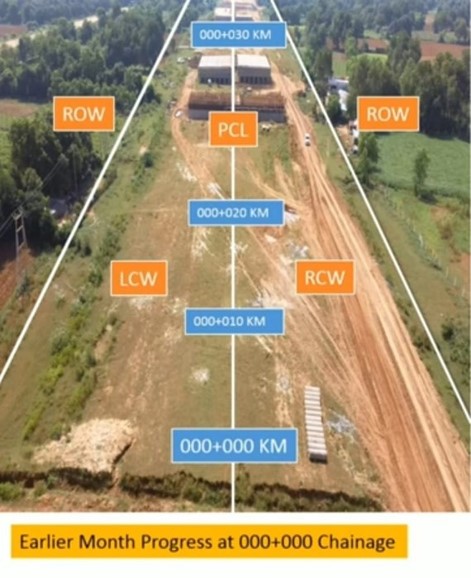
- Progress Monitoring
- Road surface analysis
- Asset Management and Maintenance
- Environmental Assessment report
FEATURES
- Progress tracking with 2D/3D mapping and geospatial data.
- High-resolution aerial imaging for comprehensive site analysis.
- Precise inspections of bridges, highways, and tall structures.
⚡
25%
Increase in operational efficiency
⚡
80%
Increasing reporting efficiency
⚡
25% Increase in operational efficiency
⚡
80% Increasing reporting efficiency
General Benefits of Drone Usage in Architecture, Engineering, and Construction
Improved safety
Improved safety by reducing manual inspections in hazardous areas.
Project accuracy
Eco-friendly practices that align with global sustainability goals.
Cost Effective
Cost savings through streamlined operations and reduced downtime.
Time Efficiency
Significantly reduce project timelines through rapid surveying.
Build Smarter: Get in Touch for Infrastructure Drone Solutions Today!