Providing tailored solutions to tackle industry challenges and meet your unique requirements with precision and innovation.
Drone Survey & Mapping
At SpatialWings, we specialize in providing drone-based aerial mapping and surveying services
that deliver precise, high-resolution data for a variety of applications. By employing the latest
drone technology,we capture accurate
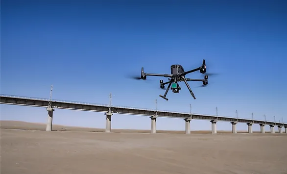
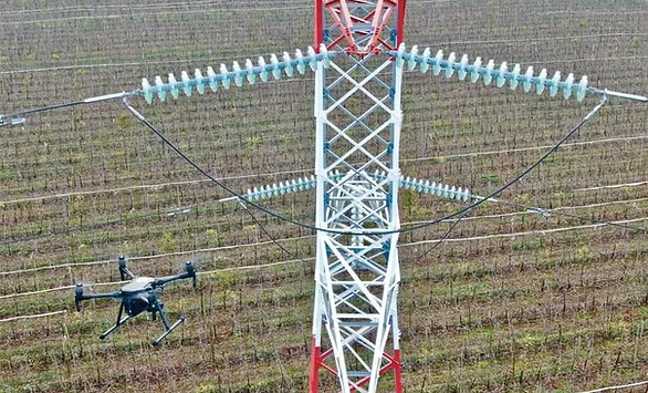
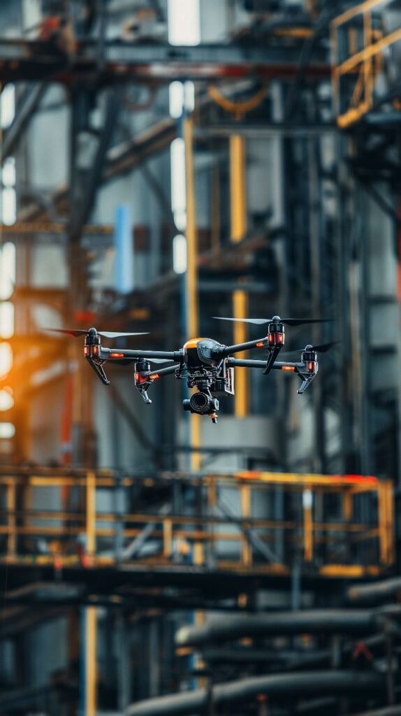
At SpatialWings, we offer drone-based asset inspection services that provide safe, efficient, and
accurate assessments of critical infrastructure. Using advanced drone technology, we can
inspect assets such as bridges,
At SpatialWings, we offer geospatial analysis services that turn aerial data into clear, actionable
information. Using advanced software, we process and analyze high-quality images and
geospatial data to create detailed models
Yes, we offer custom drone solutions tailored to the specific needs of each client.
We use top-of-the-line drones equipped with high-resolution cameras, thermal imaging, and multispectral sensors, depending on the project requirements.
Absolutely! We can provide sample reports upon request to showcase the quality and depth of our data analysis.
Drone Service - Marquee with Parallelogram Shape and Star Rating
Featured Services
DaaS
Drone as a Service
Precision mapping and surveying High-resolution imaging for inspections Aerial monitoring and data collection
SaaS
Software as a Service
Advanced analytics platforms Real-time data visualization and reporting
PaaS
Product as a Service
Customized drone systems tailored to your needs Plug-and-play solutions for various applications
PaaS
Geospatial Analytical Solutions:
Terrain modeling and 3D mapping Land-use analysis Disaster risk assessment and response planning Construction Sites
Why Choose DaaS ?
Cost-Effective
With DaaS, you only pay for the services you need, saving on expensive equipment,
maintenance, and training.
Expert Support
Our team of professionals brings expertise in drone technology and data analysis, ensuring
high-quality results without extra hassle.
Faster Results
Drones cover large areas quickly, helping you complete tasks like surveys and inspections in
less time with accurate results.
Safer Operations
Using drones for inspections reduces the need for risky, manual work, keeping your team safe
while still delivering reliable data.
Complete Drone Services for Smarter, Faster Results
Experience comprehensive drone services tailored to your needs—from aerial surveys and inspections to progress monitoring. We deliver precision, efficiency, and cutting-edge technology for unmatched results.
3 Column Drone Services
Drone Surveys
Survey large area faster
Autonomous flight
Geo-referenced data
Multiple sensors
Progress Monitoring
Cloud-based reporting easy to share
High-resolution 2D and 3D map
Geo-referenced data
Visual history timeline
Drone Inspections
Operate faster
Advanced collision avoidance systems
Geo-referenced data
Reach difficult places
Our Process
At Spatial Wings Solutions, we employ cutting-edge technology and expertise to deliver precise aerial data. Our streamlined process ensures efficiency and accuracy in every project, tailored to meet your unique needs.
Services - Spatial Wings Solutions
🔍
Consultation & Planning
We work with you to understand your specific needs and create a customized drone solution.
Consultation & Planning
We work with you to understand your specific needs and create a customized drone solution.
📷
Fly & Data Collection
Our team performs safe, compliant drone operations, capturing high-quality data from every angle.
Fly & Data Collection
Our team performs safe, compliant drone operations, capturing high-quality data from every angle.
📊
Data Analysis & Processing
Using advanced analytics and AI-driven software, we process data for accurate insights and actionable results.
Data Analysis & Processing
Using advanced analytics and AI-driven software, we process data for accurate insights and actionable results.
📄
Report & Delivery
You receive a comprehensive report detailing insights, analysis, and recommended next steps.
Report & Delivery
You receive a comprehensive report detailing insights, analysis, and recommended next steps.
Impacting Industries
Industries We Work With
⚡
Utilities
🌞
Renewable Energy
🌾
Agriculture
⛏️
Mining
🏗️
Infrastructure
🌳
Environment
🛢️
Oil & Gas
🏠
Construction
🔧
Building Maintenance
🏢
Real Estate
🌆
Urban Planning
🌲
Forestry
Industries We Work With
⚡
Utilities
🌞
Renewable Energy
🌾
Agriculture
⛏️
Mining
🏗️
Infrastructure
🌳
Environment
🛢️
Oil & Gas
🏠
Construction
🔧
Building Maintenance
🏢
Real Estate
🌆
Urban Planning
🌲
Forestry
Yes, we offer custom drone solutions tailored to the specific needs of each client.
We use top-of-the-line drones equipped with high-resolution cameras, thermal imaging, and multispectral sensors, depending on the project requirements.
Absolutely! We can provide sample reports upon request to showcase the quality and depth of our data analysis.
Our Commitment to Innovation
At SpatialWings, we are constantly evolving to stay at the forefront of technology. By integrating advancements in drone technology, geospatial mapping, AI, and immersive tech, we aim to provide forward-thinking solutions that help our clients achieve their goals with precision and efficiency.